
KCDO.pl – Data Science for Renewable Energy: Intelligent Land Selection
We use advanced data science methods to analyse and select optimal sites for renewable energy (RES) investments.
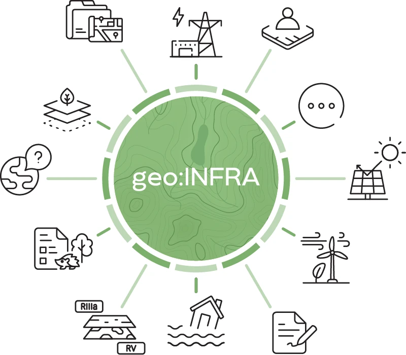
At the core of our solutions lies a database developed by our team of data science experts. It contains comprehensive geospatial information and specialised RES data (including wind conditions and solar radiation), as well as environmental data, flood risk, soil properties, local development plans (MPZP), and legal and business considerations.
Our geo:INFRA database holds over 100 million records and is continuously updated to ensure access to the most current information.
What sets KCDO.pl databases apart? Above all, it’s the high quality and accuracy of the data – meticulously cleaned and prepared for advanced numerical analysis and business applications.
We are constantly expanding our databases by adding new layers of information. Feel free to contact us to learn more about our solutions. Selected datasets are also available for purchase.
Data on bird and mammal migration, ecological corridors, and Natura 2000 areas.
These datasets are essential for assessing the environmental impact of investments and preparing environmental reports.
The first database of its kind on a national scale in Poland.
A fully digitised source of all Standard Data Forms (SDFs), containing information on protected species and Natura 2000 habitats in Poland—essential for assessing the environmental impact of investments.
A digitised and weekly updated collection of all binding Local Development Plan (MPZP) documents in Poland, with the ability to search acts by keywords. An essential database and service for urban planners, legal professionals, and investors.
For the specified plot IDs, we provide statistical information on:
types of ownership, lease status, and number of co-owners, including precise identification of State Treasury land and land under the Agricultural Property Stock of the State Treasury (KOWR).
Primary Supply Points with planned connection capacities, and low, medium, and high voltage lines.
An integrated dataset of cadastral and topographic data (BDOT10k), together with a digital terrain model and hydrography. Reference layers essential for area parametrisation and identification of objects constituting technical constraints or requiring buffer zone delineation.
A comprehensive, nationwide database of renewable energy installation locations. Contains data on photovoltaic farms, wind turbines, and biogas plants, including objects vectorised from the latest high-resolution satellite imagery.
A database of restrictions on RES siting – particularly for wind farms – containing:
the Register of Aeronautical Ground Installations with their height-limiting surfaces, and exclusion zones around existing wind turbines.
A dataset covering utility networks, including:
water supply,
sewage,
gas,
electricity,
telecommunications networks.
A database containing locations of immovable monuments, conservation protection areas, and archaeological site zones. The data enables early identification of conservation restrictions – essential for planning RES infrastructure layout and assessing archaeological supervision risk during earthworks.
A comprehensive database of landscape audits, including designated priority landscapes that constitute restrictions on RES siting – particularly for wind farms.
Air quality data: concentrations of PM10, PM2.5, NO₂, SO₂, O₃, CO, and benzene, along with station metadata and the Polish Air Quality Index.
Ready for environmental and spatial analyses, and ESG reporting.
A digital vector database of classification contours, land use types, agricultural suitability complexes, and soil quality classes.
A key dataset for planning any RES investment, determining agricultural land value, or calculating crop insurance premiums.
Verification of flood risk on a given plot or area – with recurrence intervals of once every 500 years (0.2%), 100 years (1%), and 10 years (10%).
This is essential information for any renewable energy investment.
Wind speed and power at heights of 10 m, 50 m, 100 m, 150 m, and 200 m, as well as the capacity factor for IEC1, IEC2, and IEC3 — these are key parameters used in wind energy potential analysis and wind farm design.
Key solar irradiation data relevant to photovoltaic farm investments:
DHI (Diffuse Horizontal Irradiance)
DNI (Direct Normal Irradiance)
GHI (Global Horizontal Irradiance)
GTI (Global Tilted Irradiance),
Check which building permits and notifications have been issued for your plot of interest, including the surrounding buffer zone. You can also examine entire municipalities, counties, or voivodeships.
Dear User,
Before continuing or closing the window, please read this information. By further use of the website, without changes in the privacy policy and cookies (that is, by choosing “Continue”), you agree for processing of personal data KCDO sp. z o.o. and for disclosure of information on cookies. However, you can refuse the access to this information or restrict it by changing the settings in your browser. More information can be found in the privacy policy and cookies policy.
At the same time, we would like to inform you that the Regulation (EU) 2016/679 of the European Parliament and of the Council of 27 April 2016 on the protection of natural persons with regard to the processing of personal data and on the free movement of such data, and repealing Directive 95/46/EC (General Data Protection Regulation) has been applicable within the European Union and the Country since 28 May 2018. Due to the above, please read the below information:
Data processing categories - GDPR Informative Clauses,
Data Controller